 Reston Trails
A map that fills in
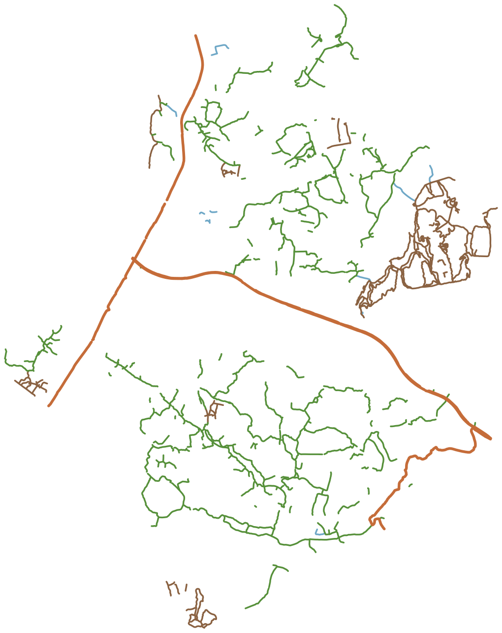
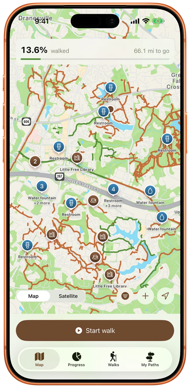
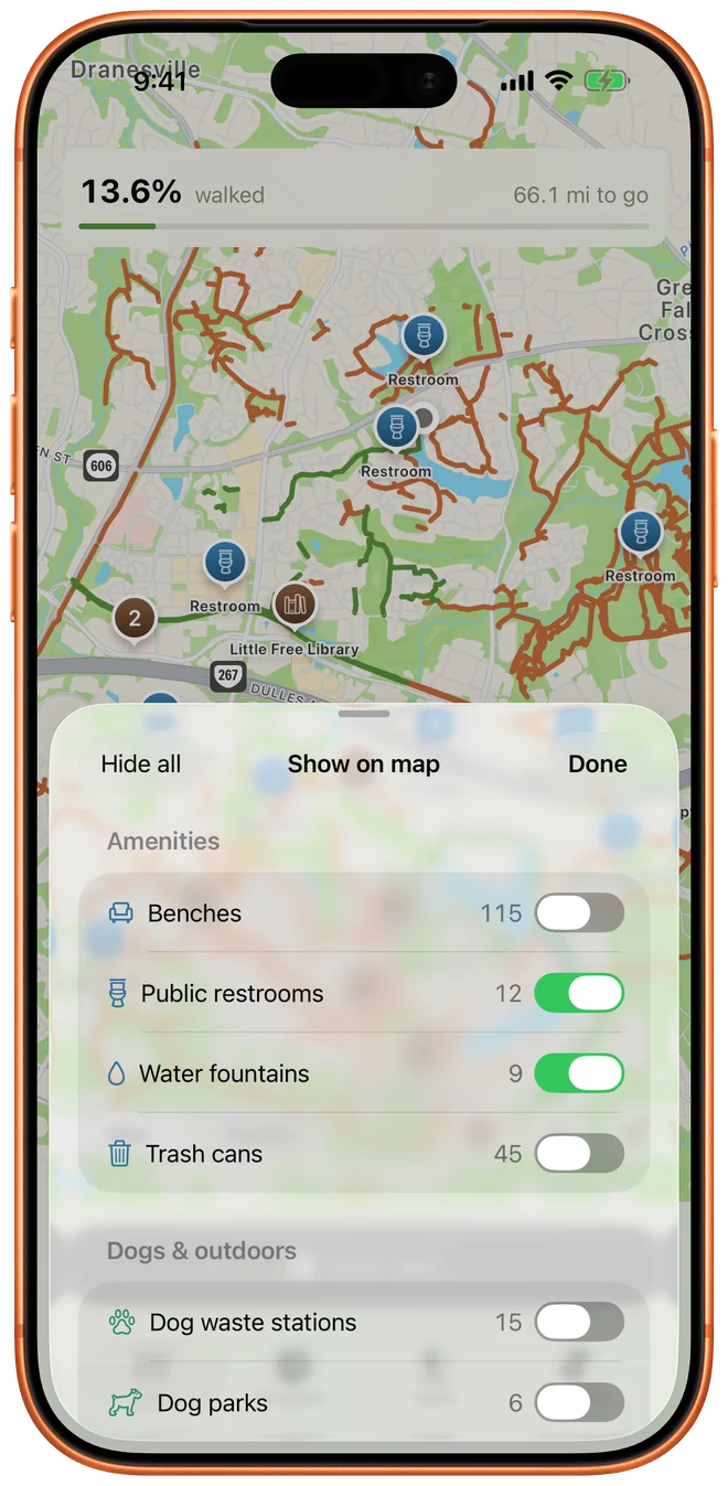
Paths you've walked turn green and the rest stay rust-orange. Walk half a path and half of it turns green. Nothing rounds up to a whole segment.
Most trail apps record the route you took. Reston Trails keeps track of the whole network: every pathway in town on one map, filled in as you walk, with a count of how much is left.
Reston Trails covers Reston and nowhere else. That narrow focus is why it can hold every path in town, work with no signal, and give you a percentage you can trust.
Paths you've walked turn green and the rest stay rust-orange. Walk half a path and half of it turns green. Nothing rounds up to a whole segment.
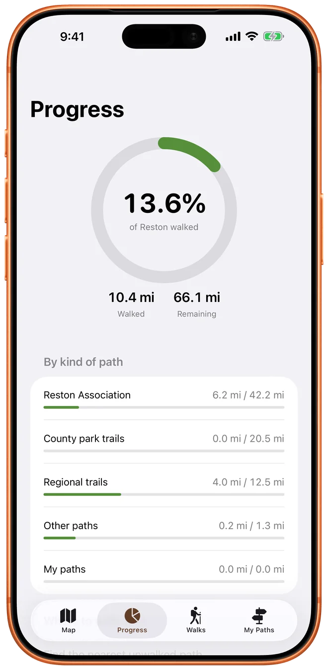
A completion ring shows how much of Reston you've walked, measured in distance. A 4,100 ft trail counts for more than a 17 ft connector. You can also see progress for each kind of path.
The app finds the nearest path you haven't walked and tells you how far away it is and how long it is. Good for a short walk after dinner.
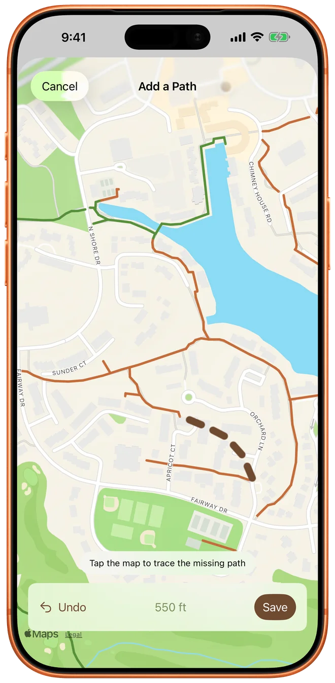
County data misses some paths. If you know one, trace it on the map in My Paths and it becomes part of your network. Walks you already recorded that crossed it get credit right away.
Show benches, restrooms, water fountains, dog waste stations, Little Free Libraries, local coffee, ice cream, public art, piers and more on the map. There are 15 kinds of place, and you can turn each one on or off.
The whole trail network comes with the app, so it works deep in the woods with no signal. The app has no account, no server and no tracking. Your walks stay on your devices.
The watch app records on its own. Start a walk, run, hike or ride from your wrist and it counts toward the same map.
Many of Reston's paths run right next to a road or right next to another path. A simple GPS app would give you credit for a path you only walked beside. Reston Trails checks more carefully:
Each path is split into checkpoints spaced 10 m apart. Your percentage is the share of those checkpoints you've reached, measured by distance.
A GPS reading near a checkpoint only counts when you were moving in the same direction as that path. Walking beside a path doesn't count as walking it.
Progress is always rebuilt from the walks you recorded. If one walk had bad GPS, delete it and the credit it gave goes away too.
| Kind of path | Miles |
|---|---|
| Reston Association pathways | 42.2 |
| Fairfax County park trails | 20.5 |
| W&OD and regional trails | 12.5 |
| HOA, VDOT and easement paths | 1.3 |
| Every walkable path in Reston | 76.5 |
Reston was planned from the start so people could walk from home to school, shops and the woods without crossing a busy road. Here are some things you'll pass on the way.
Robert E. Simon founded Reston in 1964, on his 50th birthday. The name comes from his initials, R.E.S., plus "ton." It was one of the first modern planned communities in the United States.
Lake Anne Village Center was Reston's first village center. It's a waterfront plaza of mid-century modern buildings and is now on the National Register of Historic Places. A bronze statue of Bob Simon sits on a bench there, and you're welcome to sit next to him.
Reston has four man-made lakes: Anne, Thoreau, Audubon and Newport. Lake Thoreau is named for Henry David Thoreau and Lake Audubon for John James Audubon. The app includes 14 piers and docks on the lakes.
The W&OD Trail follows the old Washington & Old Dominion Railroad bed. It crosses Reston on its 45-mile route between Arlington and Purcellville, and 12.5 miles of Reston's regional trail mileage in the app is the W&OD and trails like it.
Reston Association maintains 42 miles of paved pathway in the app. The paths run through every neighborhood and often pass under roads through tunnels, so you can walk a long way without waiting at a crosswalk.
Stream valleys like the Glade and Snakeden Branch run through the middle of the neighborhoods. Lake Fairfax Park and other county parkland add natural-surface trails, which make up 20.5 miles of the network.